The
History of 41 Brooks Road
|
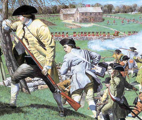
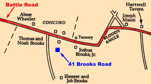
The British turned back, and began a long retreat through Concord, Lincoln, Lexington, and Arlington, being sniped at by colonial militias the entire way, including one major battle at the Lexington town green. The path of this retreat, along present-day Route 2A, is known as the "Battle Road". The fiercest fighting, other than the Battle of Lexington, took place at a turn in the Battle Road not far from here, now known as the "Bloody Angle" (see map below).
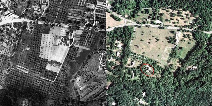
In the early 1800s, the land of 41 Brooks Road was part of a farm. The
farmhouse of the farm, today called the Noah Brooks Tavern, is the yellow home
around the corner on Route 2A. The land became an orchard, and continued to be
an active orchard until well into the 20th century. In the photos below, you can
see the farm in a pre-World War II aerial photo, and a GoogleMaps sattelite view
of the same area today. Note the rows of apple trees in the black-and-white
photo. 41 Brooks Road is circled in red on the newer map.
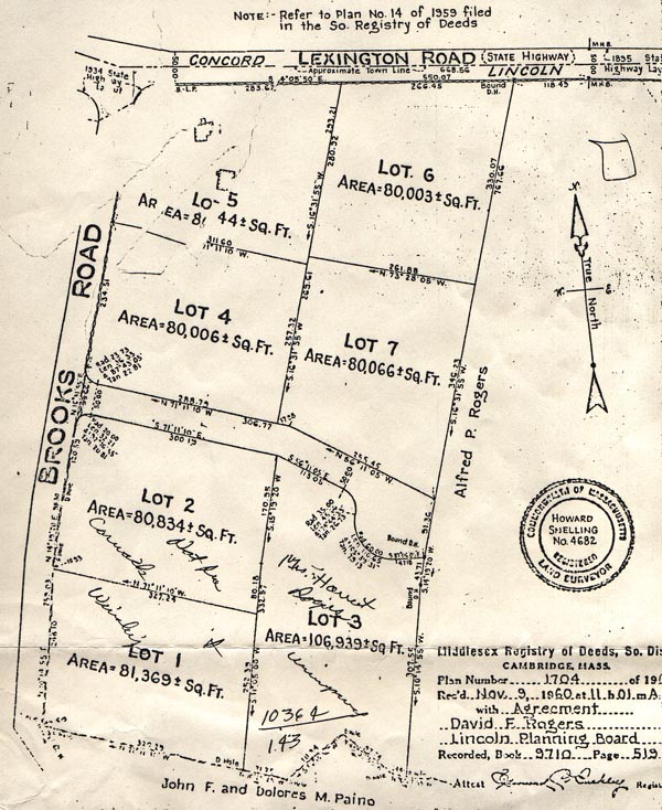
In 1960, the farmhouse and the land was owned by the Rogers family, who
decided to subdivide the land and create seven house lots. But at that same
time, development of Boston's suburbs was reaching the Lincoln area. Concerned
that history was being lost, Congress formed the Minuteman National Historic
Park to preserve the "Battle Road" and its surrounding landscapes and historic
sites. As land was purchased to form the National Park, four of those lots were
purchased by the Park Service and incorporated into the park. (Lots 4 through 7
on the subdivision plan below.) The remaining three lots were eventually built,
including 41 Brooks Road. The cul-de-sac that would have served Lots 3 and 7 was
never built; instead, Lot 3 (41 Brooks Road) was granted a perpetual easement
through the National Park for a driveway.
Today, you can walk from here
to visit much of the history of the birth of America. You can witness battle
re-enactments during Patriots Day weekend in April, or see how revolutionary era
people lived and worked during the National Park's Colonial Day weekend in
October. And even today, although the land hasn't been an active orchard for
about 50 years, there are still numerous living apple trees on the land of the
old Brooks farm; when they bloom in May, they turn the entire landscape into a
pinkish-white wonderland.
Last updated: 5-16-09